


Voting District 14, Greenbrier County, West Virginia
About
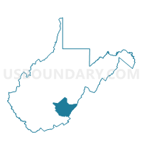
Outline

Summary
| Unique Area Identifier | 690671 |
| Name | Voting District 14 |
| County | Greenbrier County |
| State | West Virginia |
| Area (square miles) | 179.45 |
| Land Area (square miles) | 178.40 |
| Water Area (square miles) | 1.05 |
| % of Land Area | 99.42 |
| % of Water Area | 0.58 |
| Latitude of the Internal Point | 38.07771900 |
| Longtitude of the Internal Point | -80.36213640 |
Maps


Graphs
Select a template below for downloading or customizing gragh for Voting District 14, Greenbrier County, West Virginia


Neighbors
Neighoring Voting District (by Name) Neighboring Voting District on the Map
- Voting District 1, Greenbrier County, WV
- Voting District 23, Webster County, WV
- Voting District 26, Pocahontas County, WV
- Voting District 27, Pocahontas County, WV
- Voting District 29, Pocahontas County, WV
- Voting District 29, Greenbrier County, WV
- Voting District 5, Nicholas County, WV
- Voting District 79, Greenbrier County, WV
- Voting District 9, Nicholas County, WV
Top 10 Neighboring County Subdivision (by Population) Neighboring County Subdivision on the Map
- Central district, Greenbrier County, WV (12,926)
- Eastern district, Greenbrier County, WV (11,601)
- Western district, Greenbrier County, WV (10,953)
- Beaver district, Nicholas County, WV (7,540)
- Southern district, Webster County, WV (3,717)
- Little Levels district, Pocahontas County, WV (1,693)
Top 10 Neighboring Place (by Population) Neighboring Place on the Map
Top 10 Neighboring Unified School District (by Population) Neighboring Unified School District on the Map
- Greenbrier County School District, WV (35,480)
- Nicholas County School District, WV (26,233)
- Webster County School District, WV (9,154)
- Pocahontas County School District, WV (8,719)
Top 10 Neighboring State Legislative District Lower Chamber (by Population) Neighboring State Legislative District Lower Chamber on the Map
- State House District 37, WV (38,124)
- State House District 28, WV (35,480)
- State House District 36, WV (15,931)
Top 10 Neighboring State Legislative District Upper Chamber (by Population) Neighboring State Legislative District Upper Chamber on the Map
- State Senate District 15, WV (122,121)
- State Senate District 11, WV (108,768)
- State Senate District 10, WV (106,143)
Top 10 Neighboring 111th Congressional District (by Population) Neighboring 111th Congressional District on the Map
Top 10 Neighboring Census Tract (by Population) Neighboring Census Tract on the Map
- Census Tract 9504, Greenbrier County, WV (7,279)
- Census Tract 9501, Greenbrier County, WV (5,283)
- Census Tract 9506, Nicholas County, WV (5,238)
- Census Tract 9502, Greenbrier County, WV (3,891)
- Census Tract 9603, Pocahontas County, WV (2,496)
- Census Tract 9703, Webster County, WV (2,269)
- Census Tract 9505, Nicholas County, WV (1,607)
Top 10 Neighboring 5-Digit ZIP Code Tabulation Area (by Population) Neighboring 5-Digit ZIP Code Tabulation Area on the Map
- 24986, WV (5,216)
- 26261, WV (2,701)
- 24946, WV (1,533)
- 24938, WV (1,518)
- 24966, WV (1,286)
- 24991, WV (521)